


1
2
3
4
5
6
7
8
9
10
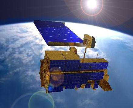
Landsat Remote Sensing 4,5,7,8
Description:Reflectance data in visible, near, short infrared and thermal bands
Organization: NASA/USGS
Spatial resolution: 30-m, 80-m, and 120-m
Time Span: 1982-Present (Updated every 16-days )
Composite Images:
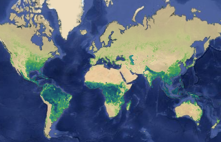
EVI: Enhanced Vegetation Index
LST: Land Surface Temperature
NDVI: Normalized Difference Vegetation Index
NDSI: Normalized Difference Snow Index
NDWI: Normalized Difference Water Index
Methods:
ACCA cloud mask: Handbook
Chander radiance to top-of-atmosphere reflectance coefficients for Landsat 4/5/7
the Landsat 4-7 SR product guide and the Landsat 8 SR product guide.
Website: Landsat Website
Google Earth Engine Catalog: the following products are used in Climate Engine
MODIS Terra Remote Sensing
Description:Reflectance data in 36 frequency bands: visible to thermal
Organization: NASA
Spatial resolution: 250-m, 500-m, and 1-km
Time Span: 1999-Present (Updated every 1-2-days)
Composite Images: (daily, 8-day, 16-day, monthly, quarterly, annual)
EVI: Enhanced Vegetation Index
LST: Daytime Land Surface Temperature
NDVI: Normalized Difference Vegetation Index
NDSI: Normalized Difference Snow Index
NDWI: Normalized Difference Water Index
Methods:
MODIS MOD09 User Guide-Version 1.3
MODIS MOD09 User Guide-Version 1.4
Website: MODIS Website
Google Earth Engine Catalog: MODIS Info
USGS MODIS ETa
Description: Remote sensing derived evapotranspiration dataset based on MODIS-thermal imagery and global weather datasets.
Organization: United States Geological Survey (USGS)
Spatial resolution: 1-km grid (1/96-deg)
Time Span: 2003-Present (Updated every 10-12-days)
Variables: (Dekadal,Monthly,Annual)
ETa: Actual Evapotranspiration
Methods:
Actual ET (ETa) is produced using the operational Simplified Surface Energy Balance (SSEBop) model (Senay et al., 2013).
Website: FEWSNET page
Google Earth Engine Catalog: this product is not available yet on the Google Earth Engine.
AVHRR
Description:The AVHRR Pathfinder Version 5.2 Sea Surface Temperature data set (PFV52) is a collection of global, twice-daily 4km sea surface temperature data.
Organization:NOAA
Spatial resolution: 4-km grid (1/24 deg)
Time Span: 1981-08-24 - 2012-12-31
Variables:
Sea Surface Temperature
Website: AVHRR Technical Specifications
Google Earth Engine Catalog: AVHRR Info
CFS Reanalysis
Description:NCEP Climate Forecast System Reanalysis dataset
Organization: NOAA NWS National Centers for Environmental Prediction (NCEP)
Spatial resolution:
After 2011: 19.2-km grid (1/5-deg)
Before 2011: 28.8-km grid (3/10-deg)
Time Span: 1979-Present(Updated every day)
Variables:
Minimum/Maximum/Mean Temperature
Minimum/Maximum/Mean Specific Humidity
Precipitation
Wind Speed and Components
Latent/Sensible Heat
Downward/Upward Shortwave/Longwave and Net Radiation
Soil Moisture
Potential Evapotranspiration
Surface Geopotential Height
Website: CFSR Website
Google Earth Engine Catalog: CFSR Info
CHIRPS
Description:Climate Hazards Group InfraRed Precipitation with Station data (CHIRPS) is a 30+ year quasi-global rainfall dataset
Organization:UCSB/CHG
Spatial resolution: 4.8-km grid (1/20 deg)
Time Span: 1981-present(Updated every month)
Variables:
5-day precipitation
Website: CHIRPS Website
Google Earth Engine Catalog: CHIRPS Info
Merra 2
Description: NASAs Modern-Era Retrospective analysis for Research and Applications, Version 2 Reanalysis dataset
Organization: NASAs Global Modeling and Assimilation Office (GMAO)
Spatial resolution:
~50-km (0.5-deg x 0.625-deg)
Time Span: 1980- present (Updated every 1-2 months)
Variables:
Minimum/Maximum/Mean Temperature
Precipitation
Website: MERRA2 website
Google Earth Engine Catalog: MERRA2 is not on the Google Earth Engine yet.
ESA Sentinel
Description: Top of Atmosphere data in visible, near, and short wave infrared
Organization: European Space Agency (ESA)
Spatial resolution: 10-m, 20-m, and 60-m
Time Span: 2015 to Present (Updated every 5/10 days)
Composite Images: (daily, 8-day, 16-day, monthly, quarterly, annual)
EVI: Enhanced Vegetation Index
NDVI: Normalized Difference Vegetation Index
NDSI: Normalized Difference Snow Index
NDWI: Normalized Difference Water Index
Website: Sentinel Website
Google Earth Engine Catalog: Sentinel Info
NOAA SNODAS
Description: The SNOw Data Assimilation System (SNODAS) is a modeling and data assimilation system developed to provide the best possible estimates of snow cover and associated parameters to support hydrologic modeling and analysis.
Organization: NOAAs The National Operational Hydrologic Remote Sensing Center (NOHRSC)
Spatial resolution: ~1-km (1/120-deg)
Time Span: 2003-10-01 to Present (updated daily)
Variables:
Snow Water Equivalent (SWE)
Snow Depth
Website: SNODAS Website
Google Earth Engine Catalog: SNODAS is not on the Google Earth Engine yet.
gridMET
Description: Global climate and climate water balance dataset for terrestrial surfaces based on WorldClim and CRU Ts4.0 and JRA55
Organization: University of California Merced (UCM)
Spatial resolution: 4-km grid (1/24-deg)
Time Span: 1979 to Present (daily data, updated every day)
Variables:
Minimum/Maximum Temperature
Precipitation accumulation
Minimum/Maximum Relative Humidity
Downward solar radiation
Wind speed and direction
Reference evapotranspiration(ASCE grass/alfalfa)
Vapor Pressure Deficit
Palmer drought severity index (PDSI)
Standardized precipitation index (SPI)
Website: gridmet Website
Google Earth Engine Catalog: gridmet Info
- Powered by Google Earth Engine and the Google Cloud -